Professional practice / 4 MIN READ
What makes a drone pilot a professional?
The aircraft gets the camera into position. Professional judgment makes the flight safe, the evidence understandable, and the result useful to someone else.
Read the guide FLY MAXWELLAERIAL IMAGERY + THERMOGRAPHY
THE FLY MAXWELL LEARNING LIBRARY
Learn how drone work is planned, what thermal images can tell you and how photographs become maps or models. Search for a topic, follow a reading path or use a practical project checklist.
THE THERMAL LEARNING ROOM
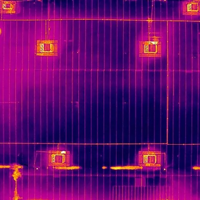
Explore the science behind the colors, try a display-scale demonstration and learn what belongs in a useful thermal record. Original lessons connect Bradley’s Level I sUAS training with real project questions.
Explore thermal learningTHE FIELD NOTES / OPEN TO EVERYONE
Search the complete guide text, then follow the linked workflow when you need file formats or a specific tool. Every guide includes primary sources.
16 guides
Professional practice / 4 MIN READ
The aircraft gets the camera into position. Professional judgment makes the flight safe, the evidence understandable, and the result useful to someone else.
Read the guideFlight planning / 4 MIN READ
A location can look open on a map and still need coordination. A good plan considers the sky, the ground, the people and the evidence the flight needs to collect.
Read the guideClient guide / 5 MIN READ
A drone flight can produce very different kinds of work. Buying the right output begins with the person who will use it and the question they need to answer.
Read the guideMapping / 4 MIN READ
Fine detail can make a map look convincing. Confidence in a measurement comes from the capture method, reference information, independent checks and suitability for the decision.
Read the guide Go further: mapping files and formats3D and photogrammetry / 4 MIN READ
A 3D model can make a complex place easier to understand. Its value depends on what was captured, how the reconstruction was checked and what the viewer needs to do.
Read the guide Go further: the Polycam workflowAutomation / 5 MIN READ
Automation can make capture more consistent. It is most useful when a repeatable route supports a clearly defined comparison and remains subject to a fresh operational review.
Read the guide Go further: FlightHub and repeatable missionsThermography / 4 MIN READ
Thermal imagery can make a temperature pattern visible. Understanding what caused that pattern requires context, a sound capture method and an honest distinction between observation and diagnosis.
Read the guide Put it into practice: prepare a thermal briefThermal mapping / 4 MIN READ
A thermal map connects patterns to location across an area. Its usefulness depends on preserving suitable source data and understanding the capture and processing workflow.
Read the guide Go further: the thermal-mapping workflowThermal applications / 4 MIN READ
Thermal imagery can reveal a contrast that is difficult to notice in visible light. A responsible search treats that contrast as information to investigate, not a guaranteed answer.
Read the guideData and privacy / 4 MIN READ
A drone project creates images, location information and often a detailed record of a real property. Professional care includes how that information is collected, stored, shared and eventually retired.
Read the guidePhotography and film / 4 MIN READ
Height can attract attention. A clear subject, a purposeful sequence and an honest story give people a reason to stay and understand what they are seeing.
Read the guideLearning and careers / 4 MIN READ
Drone work brings aviation, imaging, software and real-world problem solving together. The rewarding part is learning to turn a new perspective into something another person can use.
Read the guideThermography / 4 MIN READ
A thermal frame is a moment in a moving process. Understanding how energy reaches a surface, travels through it and leaves it makes the picture much more useful.
Read the guideThermography / 4 MIN READ
A number on the screen is an estimate produced by a camera, a scene and a set of assumptions. A useful temperature record makes those assumptions visible.
Read the guideThermography / 4 MIN READ
There is no single best time to fly every thermal assignment. The useful window depends on what should create the contrast, what might hide it and what the recipient needs to learn.
Read the guideThermography / 4 MIN READ
A useful thermal report lets the next person locate the observation, understand the conditions and decide what to do next. The strongest part of the report may be the context beside the image.
Read the guideNo exact match. Try a shorter phrase, clear the subject filter or explore the glossary.
THREE WAYS INTO THE SUBJECT
No account or signup. Follow a short reading sequence, use a checklist and come back when a project takes shape.
Understand the files, plan the location and prepare the essentials before asking for a quote.
Connect aviation knowledge with professional judgment and the skill behind the image.
Learn to separate a surface pattern from a conclusion, then see what mapped thermal data requires.
EXPLORE THE PROCESS
Change the layer to explore how a collection of photographs can become a three-dimensional representation.
EDUCATIONAL DIAGRAM / NOT A CLIENT MODEL
CAPTURE / OVERLAPPING VIEWS
Photographs from different positions show the same physical features. Coverage, focus, lighting and overlap shape what the reconstruction can use.
This simplified illustration explains the stages. A finished model needs suitable source capture, processing, quality review and an agreed purpose. A textured surface alone does not establish measurement accuracy.
Explore the full 3D workflowThe library is here to help you understand the work, whether you are planning a project or exploring the industry. Our explanations link to official sources. Real assignments still need a site-specific scope and appropriate professional review.
Explore the drone glossary Open the practical planning checklists Meet the fleet