01 / Workflow
Map the question, not just the palette.
A thermal-map request should begin with the asset, area and reason for looking. Are you trying to organize observations across a roof, locate areas for a closer review, or compare a defined set of assets? Each purpose calls for a different delivery structure. A dramatic color ramp does not answer those questions by itself.
Decide who will interpret the result and what action it should support. The recipient may need an area index, paired visible photographs or a record suitable for another professional’s assessment. Keep that downstream use in the brief. The map is one part of the evidence package, and it should help a reviewer find and discuss the relevant areas without guessing where a thermal frame belongs.
02 / Workflow
Keep the technical record behind the display.
A presentation image shows a chosen palette; a radiometric source can retain temperature information for compatible analysis. The Matrice 4T supports R-JPEG capture. Before commissioning a mapped product, ask whether the deliverable is an image for orientation, an analysis-ready thermal dataset or a report with selected observations.
Those choices affect processing and review. A screenshot used in a meeting is convenient, but it should remain connected to its source and location. Agree file naming, units, area references and the form of any selected measurements. If the customer already has a review program, confirm compatibility with a sample before collecting a large dataset.
03 / Workflow
Use a thermal-palette scene to explain the setting.
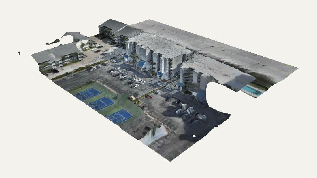
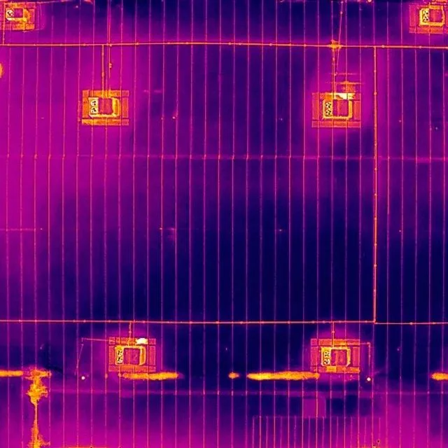
Our completed Polycam work includes a 3D property reconstruction with an Iron Red thermal-palette texture across visible building and ground surfaces. Bringing the displayed patterns into a connected scene can help a reviewer follow the roof, facade and surrounding property context. The model collection provides a practical example of this presentation approach.
That texture is a visual presentation, not a radiometric temperature dataset, a verified thermal orthomosaic or a diagnosis. Our visible-light and thermal-palette examples use different source capture versions; they are not presented as aligned overlays, a same-time pair or a measured comparison between dates. A temperature-bearing mapped product needs its own capture, processing and validation plan.
04 / Workflow
Current software changes what can be proposed.
DJI’s July 2026 Terra release added temperature-bearing 2D thermal reconstruction using paired visible and thermal imagery, including Matrice 4T capture. Visible photos provide the geometry; DJI advises against low-light collection for this workflow. Its report options include PDF and spreadsheet output.
That capability is a processing option to evaluate, not a claim that every thermal mission already has a configured map pipeline. Confirm the installed software version, license, supported source files and expected output for the assignment. A representative test area can show whether the intended recipient gets a useful result before the team expands the scope.
Source: DJI Enterprise: Terra thermal reconstruction update · July 2026
05 / Workflow
Plan for the surface and the environment.
Emissivity and reflected radiation influence what a thermal camera measures. Interpretation needs the material and environmental context, not just the apparent color difference. Discuss the subject, its operating state and the purpose of the comparison when choosing the capture window.
An inspection map, a recurring condition record and a search inquiry should not automatically share one capture plan. A night search may suit finding a thermal contrast but does not establish an appropriate visible-image network for a mapped deliverable. Let the desired result determine the conditions and the record to collect. If the conditions do not support that result, review the timing or scope before presenting the imagery as equivalent.
Source: DJI: Thermal interpretation: emissivity and reflected temperature
06 / Workflow
Turn observations into a reviewable record.
For each priority area, a useful handoff can include a locator, visible context and the selected thermal view. Keep the observation distinct from a conclusion: describe the pattern and where it appears, state relevant capture context and identify the proposed follow-up. Avoid letting the palette name stand in for an explanation.
For comparison between dates, agree how areas will be named and how changes in conditions will be recorded. A reviewer should be able to tell whether the images were captured for the same question. If dimensions matter, define a separate geometric checking method. Thermal contrast and map alignment are different qualities, and neither should be assumed from a visually smooth mosaic.
- Locate the observation within the agreed asset or area.
- Pair the thermal pattern with readable visible context.
- State the limits and the next review step in plain language.
07 / Workflow
Tell us what happens after delivery.
Share the location, asset type, approximate area, timing and purpose. Name the recipient who will use the record and any required analysis or reporting format. Explain whether you want a first look, a proposed mapped overview or a recurring program. Include what your team already knows about the subject, without assuming that thermal imagery will prove a particular diagnosis.
Bradley’s Level I sUAS thermography qualification is part of the planning conversation. Fly Maxwell will discuss a suitable capture and handoff, with the processing method, scope and availability confirmed directly. The aim is a practical record that helps the next reviewer work from evidence and context.
VERIFY THE DETAILS / KEEP EXPLORING
Sources & further reading
Original explanation by Fly Maxwell. Technical and regulatory details are linked to the responsible organizations below. Product features, software plans and operating rules can change; check the current source when planning a project or a flight.
- Matrice 4 Series specifications DJI · reviewed October 8, 2026
- Terra thermal reconstruction update · July 2026 DJI Enterprise · reviewed October 8, 2026
- Thermal interpretation: emissivity and reflected temperature DJI · reviewed October 8, 2026
Manufacturer specifications describe the product under stated conditions. They are not a promise of project accuracy, flight duration, target detection or a particular outcome.