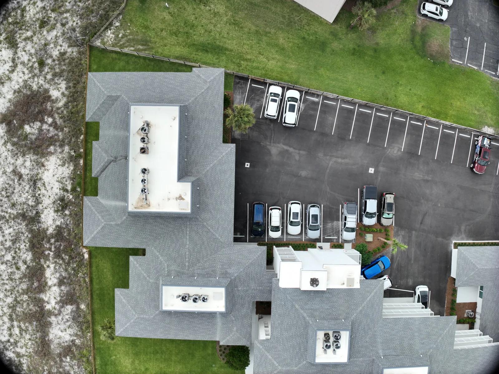
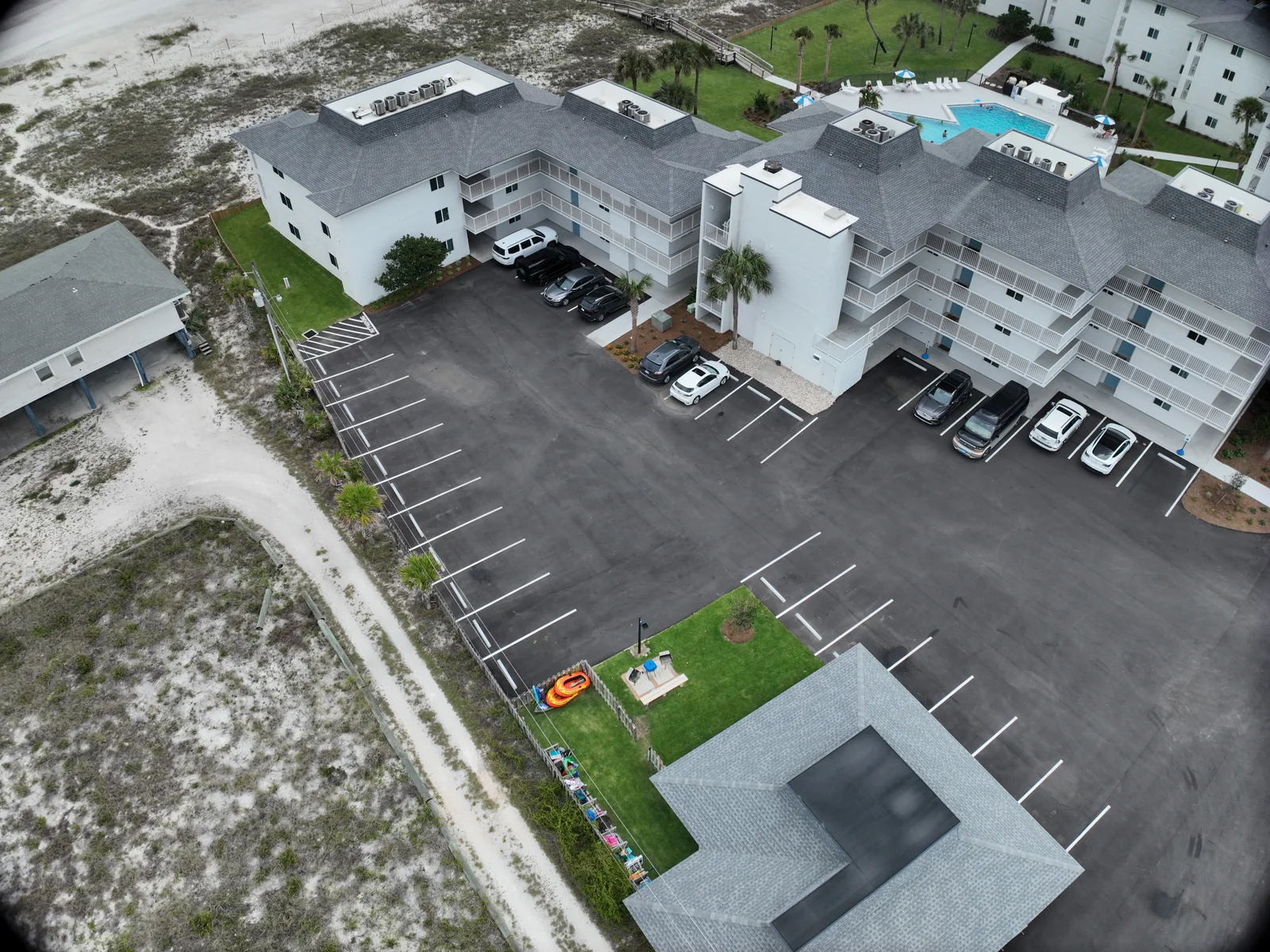
Our completed reconstructions let people explore building form, roof edges and surrounding context from different viewpoints.
When is a 3D view useful?
Use it to orient a conversation before opening a detail photograph. A visual reconstruction and a measurement deliverable have different review requirements.
We use FlightHub 2 to organize property coverage and review spatial outputs in a map-based workspace. Our workspace includes a saved Matrice 4T area route, a visible-light 3D building reconstruction and 2D roof overviews. That combination helps explain where a capture was intended to go and how the resulting property can be explored.
Each item has a different job. A route is a plan. A rendered model is a processed output. Original photographs and a scoped report provide the detail and interpretation. Keeping those roles clear helps a client move from the overall property to the particular roof area or follow-up question.
02 / Software workflow
Read a coverage plan as a plan.
A lawnmower-style route preview makes intended area coverage visible. FlightHub also presents planned image sampling, distance, duration and photograph estimates. DJI documents these planning fields alongside collection methods and overlap settings. They help prepare the assignment; they do not certify that the route was flown or that every intended image was captured.
Before delivery, reconcile the intended coverage with the actual capture set and reviewed output. The presence of a saved route alone does not establish a completed mission or a repeat-visit history.
Use overhead and three-dimensional views together.
A 2D roof overview helps a reviewer locate an area within the property footprint. An angled, visible-light 3D reconstruction adds the relationship between roofs, walls and surroundings. We use these as complementary context views. A layer named thermal does not establish calibrated temperature data, and the displayed image-sampling figure is not a survey accuracy statement.
DJI provides model preview and quality-report access, plus comparison of overlapping 2D models. Those tools support review; the checks performed and the intended use still belong in the project record.
An angled capture links the roof with parking, access and the surrounding property.
04 / Software workflow
Carry the context into a usable property record.
The useful handoff connects a location in the overview with selected original imagery, a capture date and the question being reviewed. Our connected property record explains how spatial resources sit alongside photographs and scoped reports in Liberty Shield. A contractor can identify the area; an owner can understand the context; the next visit can start with a clearer brief.
We select the resources, review the observations and assemble the client handoff. FlightHub supplies the planning and spatial context; Liberty Shield organizes the agreed property record. Access, retained source files and the delivery package are agreed for the assignment.
05 / Software workflow
Automate the repeatable parts with a clear purpose.
A recurring aerial assignment contains more than a flight path. It needs a current area list, consistent naming, a capture window and an agreed destination for the files. Begin by deciding which parts should remain comparable between visits and which parts need a fresh review. This helps the team avoid collecting similar-looking material without answering the current question.
For a construction record, that may mean stable overview priorities plus a changing milestone list. For a facility, it may mean a defined asset index and a method for reporting areas that deserve attention. Route templates and cloud tools can support those decisions, but the customer-facing value is a record people can follow and act on.
06 / Software workflow
Understand FlightHub’s role in the chain.
DJI FlightHub 2 brings route management, remote coordination and data functions into a cloud platform. It can support planning, live operations and processing or review options, depending on the devices and service configuration. Those functions should be scoped individually rather than described as one automatic end-to-end service.
Ask which part your project needs. A team wanting date-organized photographs may not need a live viewing setup. A remote reviewer may need access during an agreed window. A recurring model project may need a defined processing and export route. Describe the requirement first so software complexity does not become a substitute for a simple, useful handoff.
Current Virtual Cockpit documentation supports remote aircraft control for Matrice 4E and 4T with aircraft firmware v12.0.0 or later. It also requires the appropriate account, device binding and control authority. That is a manufacturer-supported capability, not evidence that a particular Fly Maxwell cloud deployment is already configured.
For a proposed live workflow, confirm the exact devices, firmware, connectivity, permissions and people responsible. Define who can view, who can control and who makes the decision to start or stop an operation. Test the intended handoff under appropriate conditions before depending on it for a client assignment. Keep the pilot and site coordination roles clear even when the interface is remote.
FlightHub’s manual-task documentation describes route copies associated with a task; editing a route in the library does not automatically change the existing task copy. That makes a simple version record useful when a recurring assignment changes.
For a project plan, identify the approved area, route version, capture priorities and delivery convention. Note changes to site access, obstacles, active work or excluded areas before the next visit. Retire superseded instructions from the working plan so a team does not accidentally discuss one version while executing another. Repeatability should mean an understandable process, not an obligation to follow an old route through a changed site.
Confirm resources and data access in the proposal.
FlightHub plans have different resource and feature limits. Mapping images, storage and livestream use are distinct resources; the free tier is not an unlimited operational package. Confirm the current plan and the relevant functions before including them in a deliverable.
A proposed workflow should also identify where client material is processed, which people can access it and how the finished files will be shared. Decide who maintains the archive and what happens when a viewing link or subscription ends. A useful handoff should not depend on an unexplained account arrangement. These decisions belong alongside the flight and capture scope, rather than appearing only when a customer tries to open the result.
DJI Dock 3 uses Matrice 4D or 4TD aircraft. It is a distinct equipment system from the 4E and 4T named in Fly Maxwell’s fleet. A discussion of dock-based scheduling, automatic charging or remote deployment should therefore be treated as a separate project, not as an included capability of these aircraft.
Software support alone also does not establish permission for unattended or beyond-visual-line-of-sight operation. For Fly Maxwell inquiries, begin with the location, visit cadence, output and coordinating contact. We can discuss a practical project scope, with any live coordination, processing, software or automation requirements confirmed directly. The goal is reliable organization and a useful record, with the operating method suited to the actual assignment.
Original explanation by Fly Maxwell. Technical and regulatory details are linked to the responsible organizations below. Product features, software plans and operating rules can change; check the current source when planning a project or a flight.
Manufacturer specifications describe the product under stated conditions. They are not a promise of project accuracy, flight duration, target detection or a particular outcome.
YOUR NEXT STEP
Build a repeatable record with clear oversight.
Name the views, milestones and site changes that matter. The recurring-visit checklist keeps the project record separate from the saved route.